|
|
|
|
Birch Point
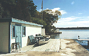
The channel narrows off Birch Point and is identified by C 385, C 384 and C 386 which then reaches open water. On the south shore just east of Birch Point is Birch Point Marina (705) 738 2473 the marina has a well sheltered harbour with land fill burbs. You can see the covered slips tucked behind a modern office waterside with good facilities, with a large black and white sign. There is adequate water here for most boats on the Trent Severn as they maintain a dredged channel of 5.5 feet and can accommodate vessels up to 37 feet. 
The east section of Sturgeon Lake is 10 miles long, averaging between 0.5 to 1.5 miles wide. Deeper draft vessel should take notice that there are hazards near the shores of Muskrat Island marked by C 388, a 6 foot shoal close south of the red buoy 142, and at mile 141.9 near McConnell Island C 390, C 392, & C 394 above mile 142.9 the lake is wide open. 
North of Muskrat Island located in Hawker's Bay is Eganridge Golf & Country Club 
Located on McConnell Island's N.W. side is Verlam Park which has a concrete wharf with 3 to 5 feet of depth. There is a swimming area, washrooms & picnic tables, but no overnight mooring. From McConnell Island you upstream course will be roughly 234 and follow the markers CBK and CBS down towards Sturgeon Point. Ashore at mile 146 opposite CBS is Greenhurst-Thurstonia which is another cottages community with substantial a T shaped concrete dock that provides a gravel launching ramp and excellent day stop for smaller boats with roughly 4 feet of depth at the outside of the dock. 

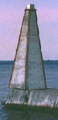
To the west of Greenhurst-Thurstonia on the south shore is McLarens Marina (705) 793 2282 . You can't miss the mini lighthouse at the end of their dock, or the galvanized roof of the covered slips and faded grey paint provide a deep water stop for transients as there is a good 8 ' of draft available if you are under 30' LOA. The sign is weathered and facilities more suited to the fisherman than the cruiser. The only shore side entertainment is a restaurant and grocery store within walking distance in Dunsford. 
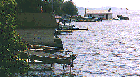
McLarens Marina has limited shore side space crowed between the road and the lake. The entire shore here has cottage docks and small boats so be considerate when approaching from the lake. 
The lake remains open as you head down towards the channel junction near the bottom of the lake. Off on your starboard side, the C 396 buoy marks a shallow hazardous area close inshore near the south shore of Sturgeon Point. Due south of mile 148 is Sturgeon Point with a concrete dock parallel to shore. 
To reach Fenelon Falls the main channel rounds Sturgeon Point and follows the west arm of Sturgeon Lake for 5.5 miles. Sturgeon Point on the north shore is a long established cottage community with lavish homes. There is a public dock and small beach here however its proximity to the channel and lack of any protection from passing boats wake make it a risky place to tie up. There are many private docks here many looking more inviting than the public dock but they are private. The photograph is looking east along the east arm of the lake. 
IF you wish to follow the main Trent Severn Channel North of Sturgeon Point you need ot exercise CAUTION as the Channel markers now cary "N" identification. IF you are not interested in the south shore or the Scugog River click here to continue north Fenelon Falls and Lock 34. On the south and west shore, perhaps more of interest to those headed into the Scugog River continue reading. For Kennedy Bay, south toward Scugog and west please use this page
Due to construction time required for Hierarchial Menu creation it may be Feb before I get this linked. We are also interested in feedback as to whether you want to see marinas on the same page or on a separate page as we did on Lake Chemong. |