www.cruising.ca Main Channel & USA shore Canadian Hydrographic Charts 1438, 1439, 14767, 14802 |

www.cruising.ca Main Channel & USA shore Canadian Hydrographic Charts 1438, 1439, 14767, 14802 |
The USA ShoreApproaching the St Lawrence from mid-lake the approach is free of shoals and obstructions. If you are cruising from St Vincents on the US shore and Wolfe Island on the North is the main shipping channel. The western most point of land here lies 2 miles south west of Cape Vincent called Tibbets Point which marked by a 69 foot white conical lighthouse easily visible for a considerable distance. 
St Vincent is on the US shore is a wonderful stop full of americana and gingerbread houses where Lake Ontario become the St Lawrence River. Located 17 miles from Kingston 13 west of Clayton and 42 miles from Oswego. The harbor at St Vincent is protected by a artificial concrete break wall 1380 feet long 500 feet from shore which is well marked with a fixed red on a white skeleton tower on the west end and a quick flashing white on the east end. Depth within the breakwater is maintained at 10 feet. FREE but somewhat open moorings. Approaching from the west the first landing point is the Town Dock opposite the breakwaters west end. The mooring against the concrete is free but space limited and without facilities. The next mooring option is the Department of Conservation Dock this has a depth along the outside of 16 feet and you can stay for two nights. There is no power but washrooms picnic tables and washrooms are available from 08:00 to 17:00 hrs.Anchor Marina can be found at the east end of the harbor tucked behind another breakwater built out from the shore and having a Z shaped entrance. This is a extremely well protected basin if you can get in as it becomes crowded. so you might call ahead. Depth run from a minimum of 6 feet at some berths to 10 feet at the gas dock located on the open and unprotected outside wall. Anchor Marina is barley visable from the vhannel with only the tops of higher vessels and their masts protrubing above the break wall. Cape Vincent is a great place to visit with all facilities within walking distance. There are banks, post office, clothing stores, gift shops, and restaurants. For supplies and necessities you will find Aubreys Supermarket Essltyne Street which runs at right angles from the main Broad way (rte 12E) which parallels the breakwater. The liquor store is found opposite the Anchor Marina at the east end on Broad way. East from Cape VincentNAVIGATION AIDS ARE ILLUMINATED WITHIN THE MAIN CHANNEL Proceeding east from Cape Vincent in the main shipping channel there is plenty of depth for pleasure craft. There are two major obstructions before you reach Clayton on the Us shore. On Wolfe Island there is a Cedar Point Park is not heavily used and does offer 3 to 6 feet of water (at datum) little used by visiting boats. Locals love it and there are park facilities ashore along with docks on both sides near the point. Given heavy weather and a tired crew it can save a medium draft boat a beat into weather and built up waves if making for St Vincent. 
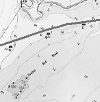
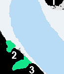
The fist of the possible difficulty is Feather Bed Shoal which lies mid north east of Cape Vincent and south west of Carlton Island with extreme shoal waters. For the visitor the prudent course of action is to follow the main channel north east passing between G 241 and R 240 approaching the shoals on your starboard side mid channel. There is a small boat passage between the shoals and the shore that locals use but we would not recommend it for visitor. If you wish to follow close the US shore we suggest that you pass both of Feather Bed Shoals and south of Carlton Island which offers reasonable pleasure vessel depths. Once clear of R 240 as you approach the SW shore of Carlton Island with its fixed green light, you can pick up the green mushroom markers on the south of the safe channel and leaving fairly close starboard make your way around Carlton Island to the south. Although you can not see the markers until you are within several hundred yards the do appear in adequate time. For those not interested in seeking harbor in Peos Bay which lies landlocked and west of Millens Bay the main channel is clear sailing and a fast passage with the current picking up. 
Approaching Carlton Island from the channel as you pass between R 238 and G 239 you will pick up a heading of approximately 013.5 degree on the official course. On Wolfe Island to your north you pass Carpenter Point and Bayfield Island on the south east shore of Wolfe Island marking Bayfield Bay which has limited depth. Along this channel there is a fixed illuminated range marker located on Irvine Point with the forward light at 33 feet and the rear light at 63 feet. As you round G 237 and G 235 (to your starboard) the channel turns to the east bearing 83.5 degrees slightly closing on the south shore of Wolfe Island as the river opens up east of Carlton Island. There are no obstructions in this area and your greatest danger is fast approaching commercial vessels. There is an un marked harbor at Peos Bay is not on navigation charts , with privately maintained buoys and having a channel holding 6 to 8 feet clear to the docks. To find the Millens Bay Marina which has transient berth for several visiting boats. Perhaps repairs are the most important reason offering mixed gas welding for aluminum,stainless steel along with prop and fiberglass repairs they specialize in inboard outboards. To find the marina steer south once you clear the end of Carlton Island and enter Millens Bay watching for a the red pole barn close inside the bay. Follow the signs and markers to the marina which is has a yellow building and blue roof. However make your approach during daylight. |
|
WOLFE . BATEAU CH . ADMIRALITY . LAKE FLEET . GRENADIER . BROCK . EASTWARD |
Features & Reference |
Cruising guides |
|
|
Sponsored by Canadianet Communications for all your digital image acquisition requirements copyright 1999 2000, 2001 all rights reserved |