www.cruising.ca Lake Fleet JOLLY & CAMELOT ISLAND Canadian Hydrographic Charts 1437, 1438 |
|
www.cruising.ca Lake Fleet JOLLY & CAMELOT ISLAND Canadian Hydrographic Charts 1437, 1438 |
| GANANOQUE . ENDYMION . CAMELOT . SUGAR . GANANOQUE NARROWS |
|
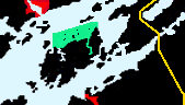
Lake Fleet Islands are on the Canadian side of Grindstone Island and derive their names from historic warships of the War of 1812 between Canada and the U.S.A.. Within the St Lawrence Parks Islands are Camelot and Endymion. I love these islands and there are many anchorages where you can safely drop your hook and enjoy their beauty without day-trippers and docks to interfere with your enjoyment. Mead , Jolly & Fat Huckelberry Islands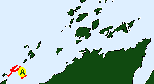
The islands tend to be smaller and most are privately owned with the usual rights to anchor in effect. However the same good guest rules apply as elsewhere. We will begin our approach from the south west end, passing south of Forty Acre Shoal along the north coast of Grindstone Island. 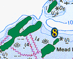
We approach from the south west we pass an suitable anchorage north of Grindstone Island, tucked between Mead Island,Jolly Island and Fat Huckelberry to the east. Assuming you are a fair sized boat and are prepared to exercise caution there are several other areas you can droop a heavy hook on considerable line. All of these have the advantage of being secluded and with little wake. You can tuck up between the tips of Jolly and Mead Islands. Camelot Island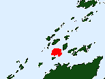
Rather than follow the Canadian Middle Channel which leads to the south of Dumfounder and Bloodletter we turn south rounding Camelot to the SW with Deathdealer Island on our west round Netlet Islands SW corner with its sedate two storied house perched on the cliff. 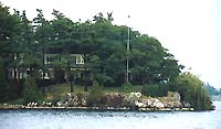
There are four areas where you can anchor around the island. The bay between Camelot Island (1) and Netley Island to the southeast face. You must enter from the south and pick your way as vessels with 6 feet of draft find their way in but not without caution. Holding is good and you can get away with a shorter than average rode. The Island is well established and has an informative parks display and is equipped with the normal services of the parks in the islands. 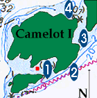
Camelot is lush and the steep valleys shield old growth hemlocks, beeches and oaks complete with deep beds of moss. A journey ashore is well worth while as there is abundant wildlife hiding in the deep thickets. 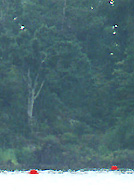
Take your time and break our your dinghy, because unlike its neighbor there are far fewer people trampling around and you can usually be quite alone on the south anchorage. |
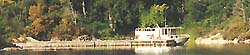
Camelot's two main crib docks (3) are to the east in the large bay between it and Niagara. Water holds its depth well over half the length of the docks but approach from the Camelot side as there are some of the famous barely hidden rocks off Niagara's south tip which usually have marking cans. 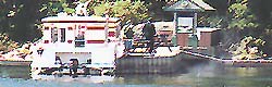
The docks on Camelot are to the found south east where you have two possibilities. In the notch (2) on the south-east is the first and smaller of the docks allowing 2 boats to moor alongside. There is a campsite, trash stations, and BBQs nearby with the toilets closer to the main docks. Niagara Island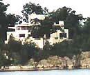
If you approach from the Canadian Middle channel you will steer south east of the flashing red marker located off Bloodetter Islands south east point. the channel between Sunset and Niagara Islands is most easily confirmed by the presence of the large modernistic house which dominates the north east corner of Niagara Island. As you clear the boathouse you will see the main crib dock to your north. |
WOLFE . BATEAU CH . ADMIRALITY . LAKE FLEET . GRENADIER . BROCK . EASTWARD |
Features & Reference |
Cruising guides |
|
|
Sponsored by Canadianet Communications for all your digital image acquisition requirements copyright 1999 2000, 2001 all rights reserved |