Wolfe Island to Long Point |
Wolfe Island to Long Point |
|
We apologize for the length of time it has taken us to update this section. For the complete Wolfe Island pages please visit the Thousand Islands section here as this page only deals with the south west shore as a passage boundary. The 2001 page presented here deals extensively with Prince Edward Bay and Great South Bay as cruising grounds. Most vessels visiting these waters will stop at Waupoos Island or Waupooos Marina as well as Main Duck Island which are covered seperatley. 
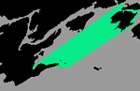
We will start this page leaving Kingston via the lower gap which lies between Amherst and Wolfe Island's. For those of you whom have been traveling the sheltered waters of the Bay of Quinte or the Bateau Channel be prepared for a sea. Once you clear the shelter of Amherst Island, assuming the wind is from its prevailing south west direction and enter the gap wave heights may be two or even three times higher than those found in the inside passages. Your mid lake conditions tend to be relatively accurate however the many shoals can produce unpredictable wave patterns. Twenety five knots of wind will often produce five to six foot waves here. The Proceeding South West: As you proceed south of Nine Mile Point on the western end of Simcoe Island which is often difficult to distinguish from Wolfe Islands itself being a small island just of the NW tip of Bear Island. As you slip between the low lying farmland of Amherst Island to your west the open lake beacons you southward to Long Point MAin Duck and the Open Lake which is situated 20 miles SW of Wolfe Island. To the east is Wolfe Island which marks the Entrance to the St Larwence Seaway. Wolfe Island is a large Island separated from the United States mainland by the south St Larwence Seaway Channel in the mouth of the St Larwence River. On the South West shore of Wolfe Island there are two bays in which you can anchor during northerly or northeasterly winds. Big Sandy Bay (3) lies between Bear Point and Long Point to the north, and Reeds Bay which separates Long Point from Yotts Point. CAUTION both bays are EXPOSED AND DANGEROUS to southerly or southwesterly winds. For more Wolfe Island visit the Thousand Island pages.
Bear Point is a densely wooded sandy point, at the southern end of Wolfe Island and has an elevation of only 10' which is situated at :
If approaching from Galoo Island and the USA shore on a clear day you will also see Tibbetts Point which is SE of Bear Point. Dark cliffs extend 1.5 miles NE to Tibbetts Point. Bear Point and Tibbetts Point are entrance points for the St Larwence Seaway.
|
|
Canadian Hydrographic Charts 1439, 22064, 14802
Proceeding South West: from Wolfe Island to Long Point. Outside Passage to Long Point |
|
This passage has few landmarks but several dangerous shoals which you should be careful to plot and stay clear of.
Pigeon Island is flat and bare with a greyish appearance, is approximately 16 feet above water level and located 5 miles WSW of Bear Point. It is situated at : 44°04' :North
Charity Shoal and South Charity ShoalCAUTION MAGNETIC ANOMALY EXIST IN AREA
Charity Shoal and South Charity Shoal , are very dangerous. They have reportedly, only 2 feet of water and are located near the international boundary, 4 miles SSW of Wolfe Island. South Charity Shoal light buoy (M6 442) marks SW end. The NW end of the shoal is marked by a cardinal buoy. They are situated at :
Allan Otty Shoal
44°NA' :North
|