Wellington |
Wellington |
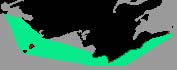
Wellington & Wellington BayWellington Bay is 4.5 miles NW of West Point, southeast of Wellers Bay. Wellington Bay is a large bight laying between Hucks Point on the WNW and West Point. Caution should be used in poor visibility as the north shore provides poor radar reflecting qualities. The most notable landmark in Wellington is the white water tower with its green horizontal band which is easily visible from Wellington Bay. There are 13 radio towers visible 4 miles NE of Hucks Point with air obstruction lights which are easy to see. A microwave tower is located 3.6 miles north of town also showing air obstruction lights. Wellington the town, is located on the southern shore of Prince Edward County directly adjacent to the northern end of Sandbanks Provincial Park. Once a grain port Wellington has joined the rest of Prince Edward County's Bed & Breakfast areas with craft and antique shops. The entrance to the harbor is ESE of Wellington between two boulder breakwaters. The channel is subject to silting although privately buoyed and reportedly dredged to 4' once each spring. Wellington West Breakwater light ( 490.5) is on the outer extremity of the breakwater on a 29 foot high white circular tower with a green upper part. 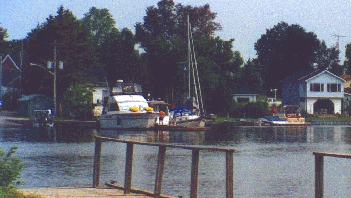
The village of Wellington has public wharf in the NW corner of West Lake, near the end of the entrance to the harbor, is 104 feet long and 18' wide and an elevation of 5 feet. Depths alongside varied from 1 to 4 feet of depth. You will find Pickards Bait & Tackle Shop is found here and offered dockage with power, launching ramp, picnic tables, fishing boat rentals, ice, rooms, some groceries, hardware, and of course bait &tackle. Westlake Marine 1 mile east of the town dock has small boat and picnic facilities, however very shallow ( 1' ) depths were reported. Willowridge Campgrounds & Lodge a half mile further east offered dockage small boat or canoe rental, dockage, camping and picnic tables. Very shallow ( 1' ) depths were reported.. |