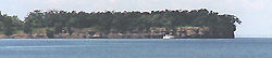
Waupoos Island
|
Waupoos Island
|
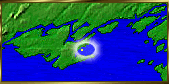
Waupoos Island Anchorage's and Island Tour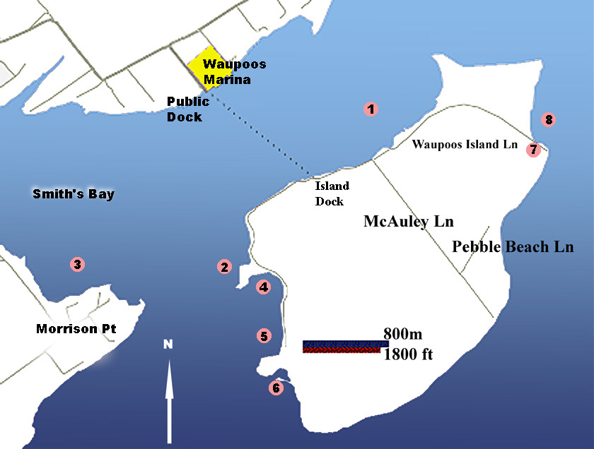
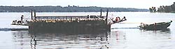
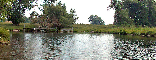
Please remember that other than the public roads on Waupoos Island, the island is privately owned and we ask you to respect property owners rights. Waupoos Island is a wonderful place and it is possible to rent one of several houses from the stewards of the Island. The water surrounding Waupoos Island is clear and the weeds look deceptively close. Anchoring off is a good plan as the insect life bites a little less away from the lights. The fish like the clear water and weeds making for excellent fishing. There are several excellent anchorages in the Waupoos Island area depending on the weather forecast. The most popular is to anchor along the north west shore of the island, north west of the island wharf. This anchorage provides excellent shelter from the NE a comfortable dinghy ride from the marina or island. It can however, be quite exposed to a south west blow building in from across Smith's Bay when combined with a weedy bottom to make holding a bit tricky. 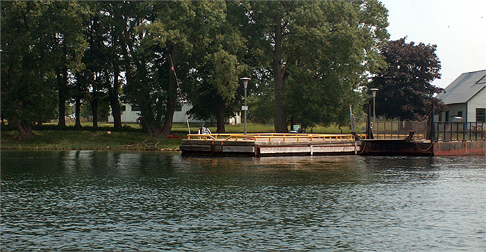 The public wharf is on the NW shore of Waupoos Island with approximately 5 feet of depth. The crib is of timber construction being 98 feet long, 12 feet wide, with an elevation of approximately 5'. Although there is room for 2 boats this is sheep right of way country, and it may be occupied by the local barge. The area between the mainland and Waupoos Island is seldom more than 10' of depth and becomes weed covered later summer. The most popular anchorage is north of the island side government dock extending north to the gravel point. The mainland Waupoos Island Government Dock is directly south of Waupoos Marina. It is ferry dock used by the local residents who have priority usage. 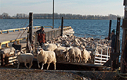
If you fancy some nice fresh lamb for dinner don't miss the opportunity to visit the Sheep Ranch Hainui Farms which is just North of the Community Center. Bob Fegal maintains a large flock of sheep not only on the property on the mainland, but he also keeps a very large flock of over two thousand sheep on Waupoos Island during the summer. During winter it is an unforgettable sight to watch the flock being brought back from the island in the Fall and led down the road by the sheep dogs. A second anchoring option I like when a prevailing SW wind picks up, is to the north of the marina breakwater along the shore leaving "swing room". Waupoos Marina has added a mooring buoy to the north of the marina for a transient wishing to have a secure mooring and you should check at the marina for assignment. As you move north toward the gentle curve of the mainland the cove ends at Blue of Blue Cottages with all the bottom having good holding, but there is an unhappy landowners who may wake you up if you get too close to shore directly west of the marina. We will start from the Government dock and work our way around the island in a counterclockwise direction. 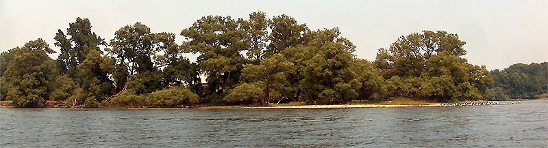
One of my favorite afternoon sun spots (2) for a landing craft ride is the old farm cove point, which is the last line of sight to the marina from the island. There is a shallow bar that extends from the point that has less than 3' of depth. 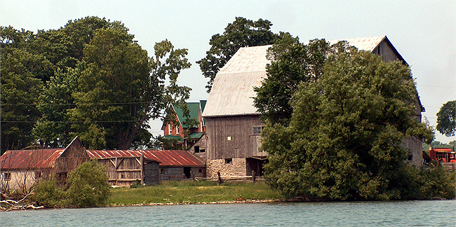
In a strong nor-easter around the point there is a small unnamed bay to the South of the ferry behind the point at 43° 58'13.62"N - 76° 59'5.54W. Chart data shows no depth but a sounding June 2006 found depths of 5 to 6' throughout most of he bay with a sandy bottom. there is a substantial farm house and outbuildings located on the NW edge of the cove and a smaller abandoned bungalow along the east side at the north end. 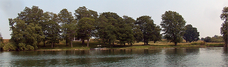
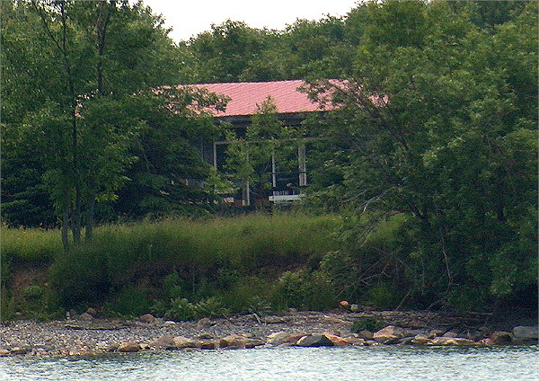
As you progress south across the larger bay there is a large two story stone house set back somewhat from the water with a private dock. Water in this area remains in the vicinity of 5' of depth. 
The house and grounds have been a subject of intensive restoration and speak of a more gracious time. 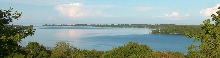
There are good anchorages to the south of Waupoos in Smith's Bay where you are protected from the prevailing winds. The bay generally holds depths of 6'' to 7' with a number of suitable anchorages along the southern shore that is Morrison Point. The other anchoring option (3) is close to this part of the island, if the wind is from south or west is Smith's Bay. Depth is roughly 10' and there is less weed growth here than close to the island. The bay can pick up quite a bit in a strong SW blow at which time it is better to move north of the marina opposite the island. 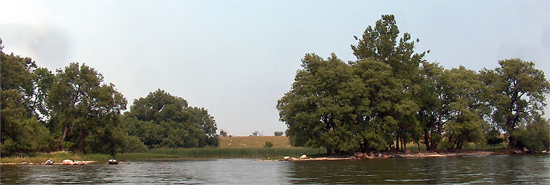
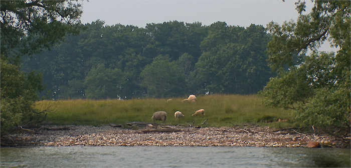
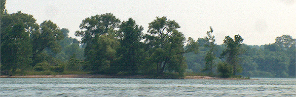
As you approach the south west tip of Waupoos Island 43°58'47.31" N 76°59'11.60" W there is another sandy point that gives way to a small bay with a lagoon. The south tip of Waupoos Island has no buildings and fair depth several hundred yards offshore. There is little to see but a rocky shore with pasture beyond punctuated by a few trees. The trip along the outside of Waupoos Island is quiet with no habitation on the shore and only the bleating of the sheep carrying across the water to mark habitation. 
The shoreline slopes gently westward after a small point that has a rock off its tip at 43°59'11.35 N 76°57'51.87" W. There as a set of small white buildings set back from the shore that are under renovation 2006. On the north east corner of the island there is another noticeable point that gives way to another shallow bay. This is often an excellent anchorage for an afternoon or any time that the wind stays in its normal southwesterly direction. 
On the east side of the bay you will see what looks like a small stream entering the lake with marshland behind it. This is the entrance to Hidden Harbour a privately dug refuge. The entrance is extremely narrow with maximum depth for only 4 or 5 feet of width so to enter you have to be dead center and unless investigated by dinghy should never be attempted in a keel boat, although I do know people who have gotten a 30' sailboats in there. Once past the entrance the depth goes to 5' throughout most of the dugout. The passage bends to the east and empties into a good sized pond with a dock against the east side. Remember this is private property. 
 |
Waupoos Marina
Waupoos Marina (613)476-2926 has emerged from the chaos of the January 2005 fire with new infrastructure and still the greatest attitude. Waupoos Marina which was originally a vegetable cannery before being converted to its current status. The facilities are simple but elegant with excellent washroom and laundry facilities combined with a small but well stocked store. In the mornings guests and residents greet the new day with coffee and muffins at the tables in front of the office. The new office and store are found in the English cottage where breakfast is served in the summer. With room for 25 or more visiting boats with an average depth on the fingers of 10 to 15 feet. There is a pump out, water, gas and diesel available while all guest docks have 15 and/or 30 amp power, Facilities provided b the marina include washrooms, laundry, shower, sauna, etc. Ice, telephone, picnic tables, horseshoes and book and/or videos are also provided. One additional feature that is most unusual is the free coffee and muffins provided to guests for breakfast. The marina maintains one of the few true wood shipwrights you will find today also an honest mechanic. Normally transients are assigned slips on B dock towards the outer end where it is easy to get in on long fingers and the water is 8' plus.Waupooos Marina hosts a popular regatta on the August 1 holiday. 
When visiting the marina please let them know you read about them here.Waupoos Marina is a secluded harbour which offers a relaxed setting on the east shore of Prince Edward County where visitors and seasonal boats may find a friendly atmosphere within the relatively sheltered waters protected by Waupoos Island. This marina at Waupoos, which means little rabbit, is a dream built from scratch. Many a local will tell you of how they laughed when the concept of building a marina was first proposed, now it is the pride of the county. The marina has a lot to do for adults and the kids alike. To the north there is a area where D dock congregates and unloads their cars a view which typifies the overall park like setting here. 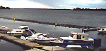
The marina has a floating TIRE BREAKWATER which give fair protection from waves and wakes yet allows a mysterious current to keep the water inside clean and fresh. The Entrance is marked by red and green lighted markers= while there are flashing markers situated on top of the floating breakwater, which may be somewhat difficult to distinguish in some weather conditions. You should be aware that the entrance channel is narrow at this writing, but that will have to be remedied very soon in order the super cat, recently built and launched at the marina, to leave. The marina itself is immediately to the north of the Waupoos ferry dock and its entrance is towards the north end of the breakwater. 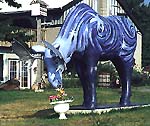
The marina's recreation facilities are extensive and well maintained, making your mind drift across the pond to England. As the main parking area is to the south you will probably first see the mural on the inside storage building as you make your way past the owners English cottage with its fine English garden. As you arrive at the docks you will be greeted by the marinas Heavenly Moose who guards the sea wall enjoying its lunch of fresh flowers , hand picked every day. 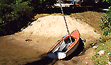
Within the property is a small beach to the north of the main complex, past the launching ramp, just before you reach the bridge spanning the man made stream flowing from the paddock fountain. Within earshot of the peacocks and other birds in their houses. It provides a shallow spot which is safe for children and with large trees to shade those watching them. 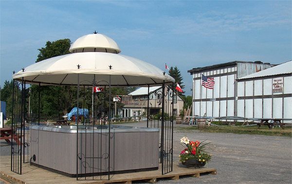
One of the most popular attractions is the new hot tub which sits near the fuel dock. There is a small office with snacks and service just opposite the gas dock. There is a safe modern playground for the kids dock side with several tables with shade covers for the adults to watch over them. Or as is the custom enjoy the fresh baked muffins and coffee every morning. The fire destroyed the old play loft but Waupoos is stretching to create more things for the younger group. There are now paddle boats with volleyball and basketball areas with more indoor recreation facilities planned as the final shape of the new marina begins to emerge. 
The Marina will be happy to help you organize your party, or you can walk up the road to the south past the orchard a kilometer or so to the Duke of Marysburgh Pub. You can sit in a screened patio or the main pub and enjoy a cold beer or local cider and if hungry taste the fresh local fish cooked up by the innkeepers.
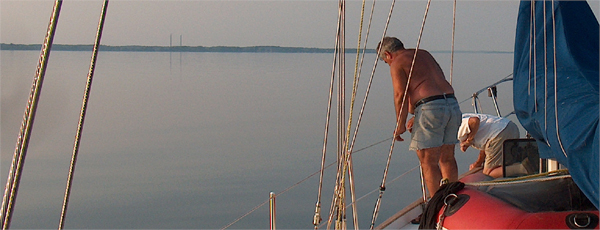
As night falls the peace of Waupoos can make one believe that you are already where you should be! For the fisherman the ferry dock provides an interesting shore side promontory projecting into promising water. The numerous smaller fish swilling in the clear water are quick to check out fresh snacks while the resident large catfish seem to love to lie just close enough to the dock to tease the visiting fisherman while never so much as investigating any bait Edgar has used. There is no end of activities ashore and you might check out the county's web site for shore side activities. |
|
Web site
Waupoos Marina & Cabins 65 County Road 38 RR# 4, Picton, Ontario K0K-2T0 Tel: (613)476-2926 Fax: (613)476-8149 Waupoos Marina Web site E-mail: [email protected] |
| Depth | Length | Transient |
| 10 feet | 65 feet | 15 |
| Fuel | Pump Out | Shore Power |
| Gas Diesel | Yes | 15 & 30 amp |
| Water | Restrooms | Showers |
| Yes | Yes | THE BEST |
| Repairs | Sales | Marine parts |
| Boats Engines | Boats Engines | Boats Engines |
| HD Crane | Trav Lift | Launch ramp |
| 35 Ton | 8 Ton | Yes |
| Laundry | Rentals | Food Service |
| Yes | Yes | close |
| Hot Tub | Sauna | Cabins |
| Yes | Yes | Yes |
| Recreation | Season Berths | Live Aboard |
| close | 71 | YES |
| Main Duck Island Direct from Wolfe South Bay Long Point Smiths Bay Halfmoon Bay |