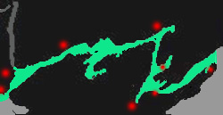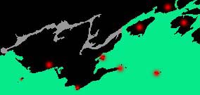
Bay of Quinte2018, 2064, 2061, 2060, 2017, USA 1439 |

Bay of Quinte2018, 2064, 2061, 2060, 2017, USA 1439 |
| PORT | WAYPOINT | LATITUDE | LONGITUDE |
| Kingston | KK 2 | 44° 13.40':N | 76° 28.88':W |
| Collins Bay | Entrance | 44° 13.10':N | 76° 37.50':W |
| Amherst Isl | .5 N of Stella Bay | 44° 10.92':N | 76° 41.72':W |
| Everett Point | N Channel | 44° 13':N | 76° 35':W |
| Picton Bay | off QP5 | 44° 01.17':N | 77° 07.90':W |
| Presqu'ile Bay | R&W fairway .5 E of pt. | 43° 59.95':N | 77° 39.80':W |
| Murray | Canal | not available | not available |
| Trenton | RL QTA | 44° 05.93' :N | 77° 30.87':W |
| Belleville | RL Q 54 | 44° 08.96':N | 77° 22.38':W |
| Deseronto | marina buoys | 44° 11.57':N | 77° 02.68':W |
| Hay Bay | entrance from L Reach | 44 ° 05.63':N | 77° 04.60':W |
| Picton | close QP 5 | 44° 01.18':N | 77° 07.79':W |
| Long Reach | Youngs Point | 44° 03.17':N | 77° 07.80':W |
| Bath | RL 1/2 S | 44° 10.42':N | 76° 45.75':W |
| Pryners Cv | Indian Point | 44° 07':N | 76° 51':W |

Outside Route2018, 2064, 2061, 2060, 2017, USA 1439 |
| Wolf Isl Long | Point KL3 | 43° 56.28':N | 76° 51.20':W |
| Waupoos Isl. | mi S in PEB | 43° 57.60':N | 76° 59.63':W |
| Long Point | Harbor KL3 | 43° 56.28':N | 76° 51.20':W |
| Main Duck Isl | Schlhse. Bay ent. | 43° 55.62':N | 76° 36.77':W |
| Point Petre | Point Petre | 43° 50':N | 76° 53':W |
| Scotch Bonnet | Island | 43° 54':N | 77° 32':W |
| Wellington Bay | .5 SW ent. | 43° 56.55':N | 76° 51.21':W |