| Ashbridges Bay I Outer Harbor I Toronto Island I Downtown I West Gap I Ontario Pl |

Toronto Western Gap |
|
Western Gap Buoy TT 3 43 °37.86' :N , 79 °20.84' :W |
|
The Western Gap is east of the geododistic dome which identifies Ontario Place. To the south is Toronto Island with the airport hangers and taxiways bordering the southern edge of the gap. 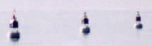
Caution the Western Gap is extremely busy and narrow. It is critical that you pay attention to the range and sailboats should motor through the gap. Most commercial traffic now uses the main eastern gap for entry to the inner harbour. CAUTION- low flying aircraft approach and land at the Island airport. Obey, the keep out postings, white and orange buoys, and light buoys which are at both ends of the airport runways. 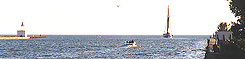
Toronto Western Gap itself is a narrow channel with a minimum width of 300 feet and minimum depth of 27 feet. The sides is are concrete with no place to pause or tie up. CAUTION a passenger ferry crosses the western Gap every 15 " to the island airport. 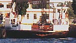
Toronto Western Gap Lights and Buoys. If approaching the Western Gap from the west your way point is TT 3 (515) which is a flashing Green illuminated buoy. 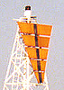
There are two privately maintained lights to the west of Toronto Island south of the western gap mounted on tripods. 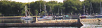
Approaching the Western Gap from the west or to the north shortly after exiting the gap is a break wall which separates a sheltered basin. This basin is entered through three gaps in the break wall to gain access to The Alexandera Yacht Club (1) and the National Yacht Club (2). Note only two openings are lit. The National Yacht Club (2) Midway along the north wall, east of the National YC is the Alexandera Yacht Club (1) |
|
Alexandera Yacht Club (1)
|
National Yacht Club (2) [ National YC Website ] Toronto Phone: 416-260 8686
|
| Ashbridges Bay I Outer Harbor I Toronto Island I Downtown I West Gap I Ontario Pl |